25 Amazing Places Nearby
from Abrams Creek Retreat, Mt. Storm, WV 26739
- The Purple Fiddle (detailed below) -- live mountain / bluegrass music and orgainic foods
- Lena's-- an new bakery serving pastries, cakes, and sandwiches/coffee.
- Mountain Made Gallery -- www.mountainmade.com -- a large collection of local artist handicrafts.
- Sarianni's Pizza -- a local hang out and pasta/ pizza place
- an Art Co-op -- featuring local artwork from about 100 artists
- Hell Bender's Burrito's -- a new Burrito place with great vegitarian options
- Golf at Wisp Resort, Deep Creek Lake: about 40 miles from Abram's Creek Campground:
Golf at Wisp -- click here - Golf at Canaan Valley: About 35 miles from Abram's Creek Campground:
Golf at Canaan Valley Resort -- click here - Mill Creek Country Club: (located between Keyser and Burlington, WV)-- about 20 miles east of Abram's Creek Campground on Rt. 50 -- 18-hole golf course along beautiful Mill Creek. Carts available -- Very inexpensive. Call for details and prices: 304-289-3160
- Polish Pines Golf Club: located in Keyser, WV, about 15 miles from Abram's Creek campground. 301-786-4131. Carts available -- Very inexpensive.
- Alpine Lake Golf Club: located in Terra Alta, WV -- An 18 hole golf course -- very affordable. About a 40 miles from Abram's Creek campground. Call 800-752-7179 / 304-789-2481.
Golf at Alpine Lake -- click here
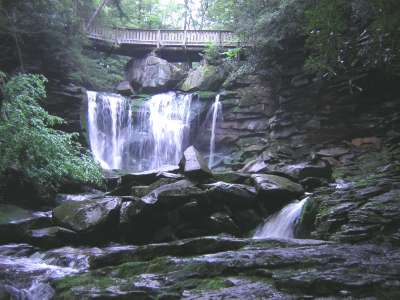
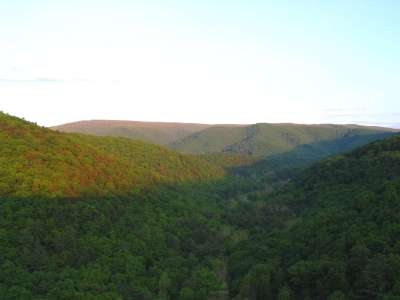
| 1. Swallow Falls State Park (Oakland, MD) 34 miles from Abram's Creek Campground |
A magnificent 37 acre ancient hemlock and white pine forest with 2 rivers joining in the park (the Youghiogheny River and Muddy Creek), 4 waterfalls, and canyon and boulder filled hikes along the river connecting the 4 waterfalls. Simply the most amazing place within 100 miles of Abram's Creek. And you can swim and play in all of it.
CAUTION: there can be dangerous currents, swift, cold waters, drowning potential, slipping potential. Popular with locals, but use common sense, particularly after rains when waters are higher and hydraulics beneath waterfalls are stronger and rocks are slippery and wet. No Dogs allowed in park but okay on opposite side of Yough river.
For photos / additional information & directions:
More Info. / Directions & Photos -- click here
and click here for more photos
and click here for dangerous whitewater kayak conditions
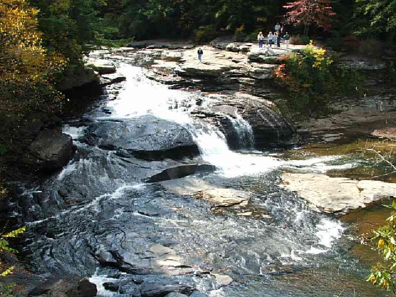 Upper Swallow Falls on the Youghiogheny River |
 Muddy Creek Falls -- 63 feet - highest in MD |
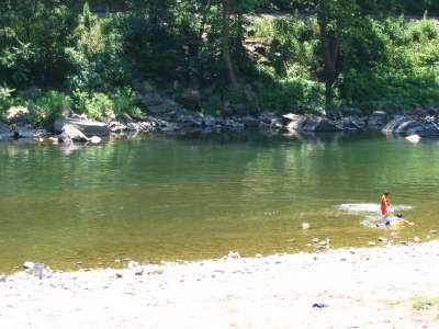
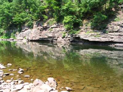
| 2. Schell Road Swimhole and Laurel Run (WV/MD) 5 miles from Abram's Creek Campground (rough roads) |
For lots of photos / directions: www.abramscreek.com/schell_rd_laurel_run.html
 N. Branch of the Potomac River (Schell Rd. swimhole) 20-25 feet deep on cliff side |
 Laurel Run at the N. Branch of the Potomac Waterfall and pool #4 |
| 3. Mt. Storm Lake (Mt. Storm, WV) 10 miles from Abram's Creek Campground |
For lots of photos / directions: www.abramscreek.com/Mt-Storm.html
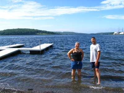 Mt. Storm (superheated, thermal) Lake popular with local swimmers, divers, and boaters |
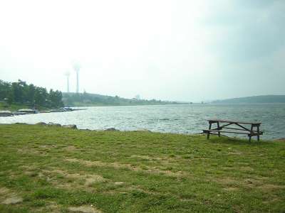 The lake waters approach 100 degrees in summer and remain in the 80's/low 90's in Fall |
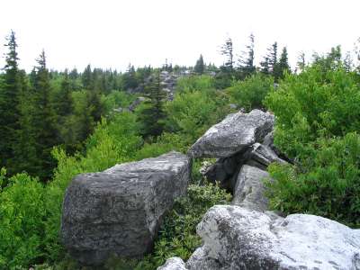
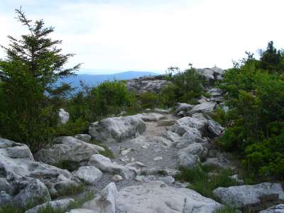
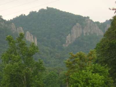
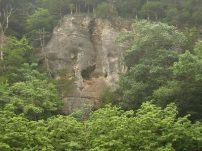
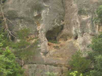
| 4. The Pinnacle (WV) 12 miles from Abram's Creek Campground |
For lots of photos / directions, click here: Pinnacle Gallery
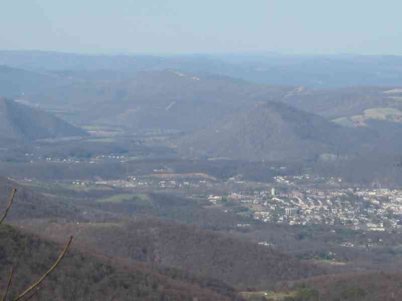 360 degree views after a very short walk |
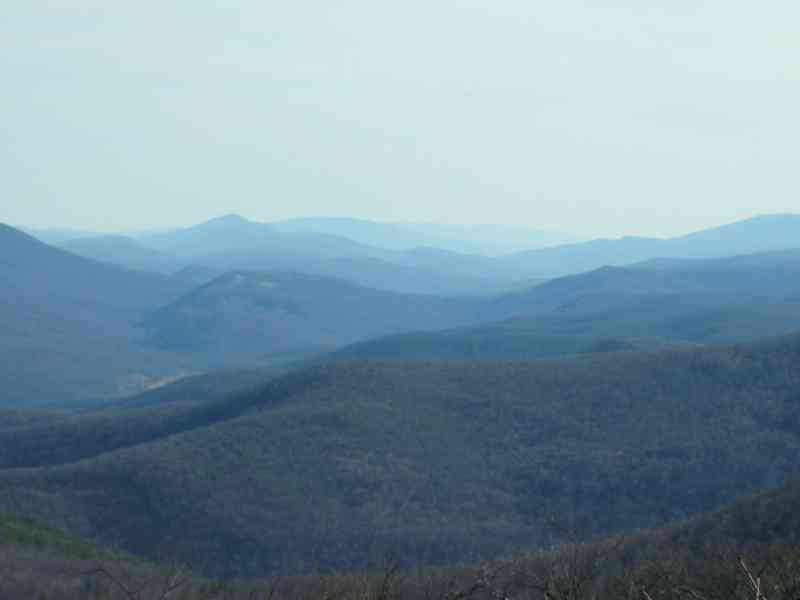 100 mile views on a clear day |
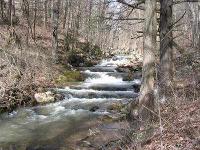
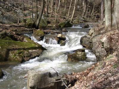
| 5. Ghost Towns of the Upper Potomac Rail Track Hikes (WV / MD) 5 to 10 miles from Abram's Creek Campground |
For lots of photos / directions, click here: www.abramscreek.com/galleries/gormania-rail-hike/index.html
Rail Hike from Kitzmiller, MD (Blaine, WV) upstream towards Schell Rd. Swim-hole: An extraordinary 8 mile round-trip rail hike along the N. Branch of the Potomac River is chronicled in photos in this gallery. Go by an abandoned ghost town once called Potomac Manor or Dill (private property- be respectful). With a couple of dozen structures, homes, out buildings, garden and fountain structures and more, this former virgin forest logging town died when the virgin forests accessible along the rail lines were obliterated early in the 20th century.
For lots of photos / directions, click here: http://www.abramscreek.com/galleries/rail-hike-kitzmiller/index.html
 19th century rail town of Gormania, WV |
 N. Branch Potomac cascades off the tracks |
| 6. Cathedral State Park (WV) 20 miles from Abram's Creek Campground |
Directions: From Abram's Creek or Mt. Storm, simply proceed on U.S. Rt. 50 West for about 20 miles -- just a couple of miles past Rt. 219 you will see the park on the right hand side (note: you will pass through Maryland briefly just after Gormania).
For photos and further description: (www.cathedralstatepark.com)
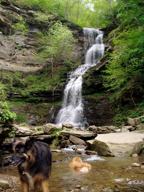 Cathedral Falls |
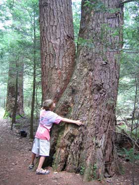 Hug an old Hemlock |
| 7. Deep Creek Lake State Park (McHenry, MD) and accompanying ski resorts, golf... 35 miles from Abram's Creek Campground |
Wisp Ski Resort at Deep Creek offers a year round resort which includes a white water recirculating river (call ahead for reservations) and a single or two person speed controllable roller coaster that glides through forested tracks.
Directions: From Abram's Creek or Mt. Storm, simply proceed on U.S. Rt. 50 West for about 18 miles and then turn right onto Rt. 219 North -- continue through Oakland until you see a virtual Austrian city (huge) on the lake.
For further details / photos: www.visitdeepcreek.com
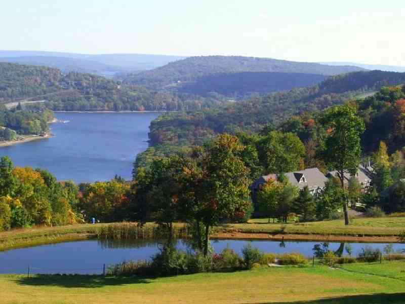 A beautiful high mountain lake resort town |
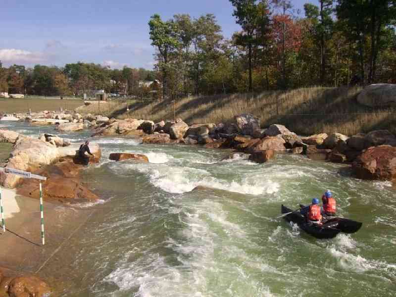 The recirculating river at Wisp Ski Resort |
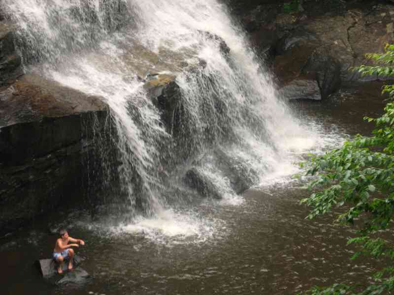
| 8. Blackwater Falls (Davis, WV) 27 miles from Abram's Creek Campground |
For photos / more information: www.blackwaterfalls.com/
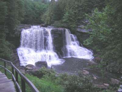 Blackwater Falls State Park 62 foot tall double falls |
 Elakala Falls at Blackwater Falls State Park Lots of waterfalls downstream... |
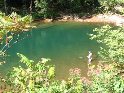
| 9. Welton Park & Eagle's Nest Outfitters (Petersburg, WV) 27 miles from Abram's Creek Campground |
Eagles Nest Outfitters is your base camp while you explore the 909,137-acre Monongahela National Forest. Miles of hiking and biking trails surround their Outdoor Center where they can custom tailor canoe/kayak/whitewater rafting trips, camping and fishing sojourns to suit your taste. They offer 12 wonderful trips on over 80 miles of river right out our front door on the S. Branch Potomac near Welton Park!
Eagle's Nest Outfitters, Peterburg, WV
Directions to Welton Park / Eagle's Nest Outfitters from Abram's Creek: Take Rt. 50 West to Rt. 42 South (in Mt. Storm). Follow Rt. 42 down the mountain to Petersburg. Keep on Rt. 55 east until you reach the end of town. The park is about 1 mile beyond the town of Petersburg on Rt. 55.
 Welton Park just east of Petersburg on Rt. 55 South Branch of the Potomac River |
 Great swimming with high cliffs overhead Welton Park is quite magnificient |
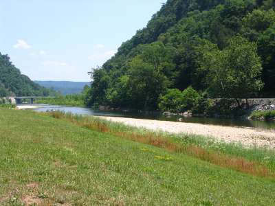
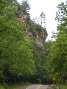
| 10. Seneca Rocks (WV) 40 miles from Abram's Creek Campground |
Directions: Proceed on Rt. 50 east to Mt. Storm -- about 3 miles. Turn left onto 42 -- follow past Liberty gas, down mountain to Peterburg. Terminates at Rt. 55 -- bear right onto Rt. 55 west -- continue about 15 more miles to Seneca Rocks -- great riverside scenery.
Click here for more photos of Seneca Rocks.
Click here for info. on rock climbing at Seneca Rocks
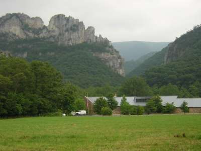 Seneca Rocks Visitors Center off Rt. 55 Yokum's Retaurant and General Store across the street |
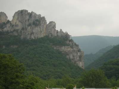 Great climbing / hiking expeditions here (about 45 minutes from Abram's Creek) |
| 11. Dolly Sods Wilderness Area (WV) 17 miles from Abram's Creek Campground |
(note: rough gravel and dirt roads throughout park)
Directions: Proceed on Rt. 50 west about 3 miles to Mt. Storm, turn left onto Rt. 42 towards Petersburg -- continue past the Liberty Gas and down the mountain. Right hand turn past Best convenience store on left.
Click here for more photos of Dolly Sods Wilderness Area
and Click here for even more photos of Dolly Sods Wilderness Area
 Dolly Sods wilderness area |
 Beautiful hiking trails |
| 12a. BackBone Food Farm & X-C Ski Farm (Oakland, MD) 20 miles from Abram's Creek Campground |
Located at the foot of Backbone Mountain in Pleasant Valley , MD, Backbone Food Farm is a small family farm holding on to the idea that small scale, independent agriculture, stewardship and diversity are not only ideas from the past.� Entering their tenth season as organic growers , they market their products through their CSA (in its 7th year), local farmers markets and local restaurants.
Managed and owned by Max and Katharine Dubansky
530 Lynndale Rd.
Oakland MD 21550
301-334-5633
For additional information / directions:
BackBone Food Farm and X-C Ski Farm - click here
| 12b. Mountain Fresh Farmer's Market (Oakland, MD) 20 miles from Abram's Creek Campground |
Mountain Fresh Farmers' Market - Oakland
Town Parking Lot, 2nd St. & Town Park Lane
Wednesday: 10:00 am to 1:00 pm June 13 - October 24
Saturday: 10:00 am to 1:00 pm June 9 - October 27
Contact: Garrett County Extension Service 301-334-6960
www.mountainfresh.org
WIC and Senior FMNP Checks Accepted
Mountain Fresh Farmers' Market - McHenry (New Location)
Parking Lot of Deep Creek Volunteer Fire Department
1906 Deep Creek Drive .
Monday: 4:00 p.m. to 6:00 p.m. June - September
Contact: Garrett County Extension Service 301-334-6960
www.mountainfresh.org
WIC and Senior FMNP Checks Accepted
| 13. Church View Farm -- Sustainable Farming (Romney, WV) 30 miles from Abram's Creek Campground |
 |
Local Farm with sesaonal organic produce, honey, natural and organic grocery prodcuts... Steven and Ruth Martin Church View Farm Three Churches (Romney), WV Phone: 304.822.3878 Email: churchviewfarm@frontiernet.net Web site: http://churchviewfarm.info Blog: http://churchviewfarm.blogspot.com Product List: http://churchviewfarmproducts.blogspot.com Email: churchviewfarm@frontiernet.net Romney Farmers Market: http://www.romneyfarmersmarket.com WV Products: www.wvfarm2u.org For farm updates,news and announcements please subscribe with your email address at our Blog |
 |
| 14. The Romney Farmer's Market (Romney, WV) 30 miles from Abram's Creek Campground |
Romney Farmers Market: http://www.romneyfarmersmarket.com
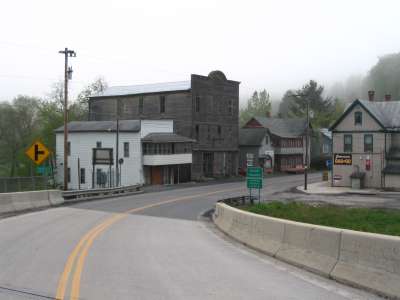
| 15. / 16. Towns of Thomas and Davis (WV) 25 miles from Abram's Creek Campground |
For photos / additional information:
More about Davis, WV - click here / More about Thomas, WV - click here / and even more about Thomas, WV
Thomas includes:
Davis includes:
Directions to Thomas / Davis from Abram's Creek: Take Rt. 50 West to Rt. 42 South (in Mt. Storm). Proceed a few miles, then bear right onto Rt. 93 towards Blackwater Falls / Canaan Valley. Continue to dead end at Rt. 32 -- bear right to get to Thomas, left to get to Davis. If going to Thomas, go a couple of miles, and at end of town, make a hard left U-turn along one-way river front street -- Rhythm is the second shop and Purple Fiddle is the last shop at the end of this small river front strip. If going to Davis, proceed about a mile and you will find the heart of town about where Sarianni's Pizza is located. Park here.
| 17. Canaan Valley (WV) and accompanying ski resorts, golf, horse back riding, ski lift rides...) 35 miles from Abram's Creek Campground |
For more information / photos: http://www.canaanvalley.org/
| 18. The Purple Fiddle (Thomas, WV) 25 miles from Abram's Creek Campground |
The menu includes organic and natural healthy foods as well as a significant gourmet soda and beer selection + great gourmet coffees (my favorite wrap is called "World Peace").
For more information / band-music schedule: www.purplefiddle.com
| 19. Golf Courses near Abram's Creek Campground |
| 20. Grover Hole along the Dry Fork River (Harmon, WV) about 40 miles from Abram's Creek |
 Road leading to Grover Hole outside Harmon, WV |
 ...small cliffs are popular to jump from |
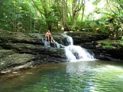
| 21. Mill Run Waterfalls / Mill (Anitoch, WV) 18 miles from Abram's Creek Campground |
Proceed about 18 miles east on Rt. 50, turn right onto Knobley Rd. -- proceed about 2 miles -- to right of old Grist Mill
More on Grayson's Gap - click here
 Mill Run, just upstream from the the old Grist Mill (circa 1767), in Antioch, WV |
 These falls and pools provide popular summer dipping pools |
| 22. The Smallest Church in the lower 48 states (Silver Lake, WV) 25 miles from Abram's Creek Campground |
Proceed on 219 South (towards Thomas) to the town of Silver Lake.
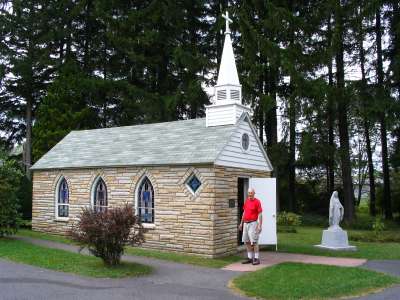 The smallest church in the lower 48 |
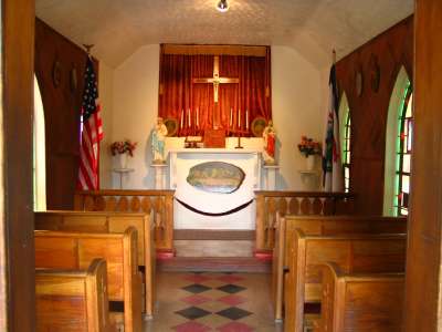 Complete with seating and altar |
| 23. Stoney River Hike 5 miles from Abram's Creek Campground |
Directions: Proceed on Rt. 50 past the town of Mt. Storm where Rt. 42 interesects Rt. 50 and continue on Rt. 50 just a couple of more miles to the green truss bridge -- Stoney River is below. Park near the bridge along Rt. 50 and hike North or South.
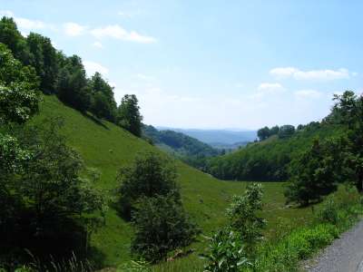
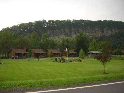
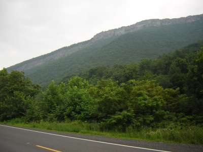
| 24. Sights along Rt. 55 (WV) 25 - 40+ miles from Abram's Creek Campground |
Directions to Petersburg: Proceed on Rt. 50 west about 3 miles to Mt. Storm, turn left onto Rt. 42 -- continue past the Liberty Gas and down the mountain. Rt. 42 terminates at Rt. 55 in Petersburg. Go left towards Welton Park and right towards Seneca Rocks, Seneca Caverns, Smoke Hole Caverns...
 Baker Rocks along Rt. 55 |
 Also an old general store located here off Rt. 55 |
 Roadside scenery along Rt. 55 |
 Up close and personal (more like Utah than WV) |
 Jutting stonework by nature along Rt. 55 |
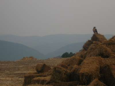 A hawk watches over new highway Rt. 55 construction |
 Town of Cabins, WV off Rt. 55. |
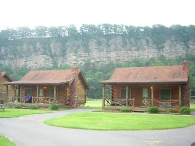 Nice cliffs in the background and river below |
 More cliff bluffs off Rt. 55 |
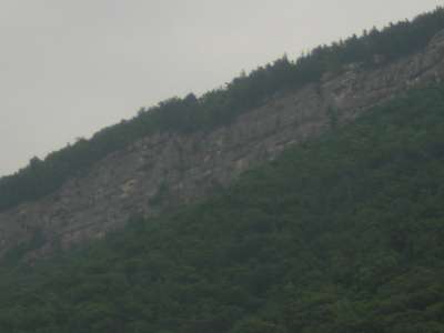 on the way towards Seneca Rocks |
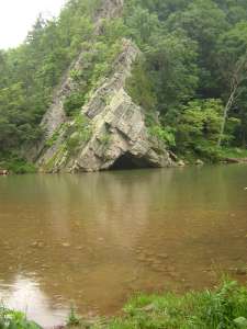 More Rt. 55 scenery en-route to Seneca Rocks This is the North Branch of the South Fork of the Potomac River |
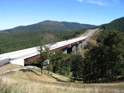 Clifford Hollow off new Rt. 55 by-pass (Corridor-H) |
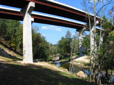 Another view of the new Corridor-H (Rt. 55 bypass) highway |
 Clifford Hollow off new Rt. 55 by-pass (Corridor-H) |
 View looking down into Clifford Hollow from bridge |
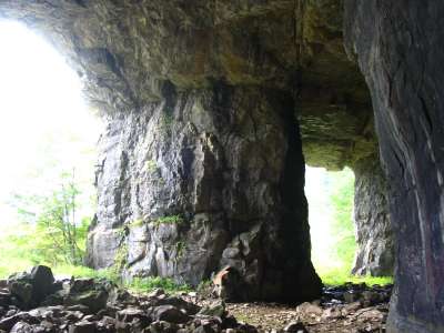
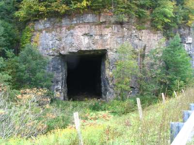 Rt. 55 cave just before Elkins, WV |
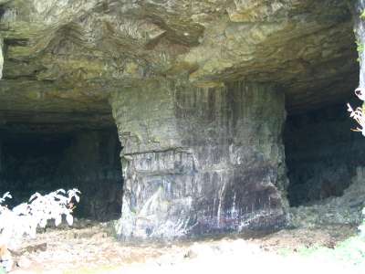 a giant pillar (apple core) supporting the roof |
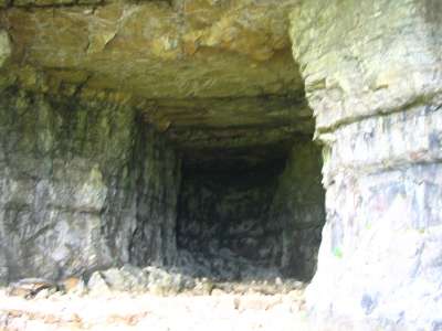 Around the interior you go |
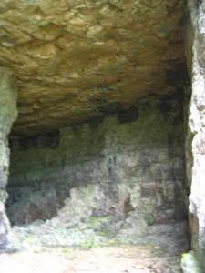 and cavernous inside (50 feet high?) |
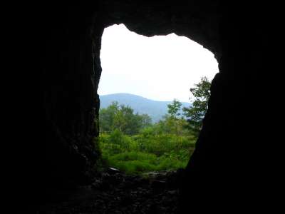 A view out of one of two entrances |
 May flood during non-drought |
| 25. Miscellaneous Places Nearby (WV / MD) 5 to 40 miles from Abram's Creek Campground |
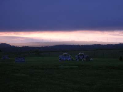 Line of Windmill turbines near Thomas / Davis, WV. |
 150 foot blade diameter |
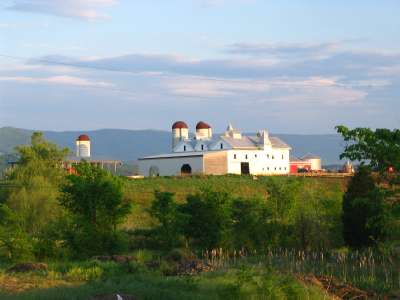 An interesting farm as seen from Rt. 28 Rt. 28 connects Rt. 55 to Rt. 50 |
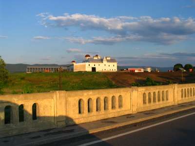 Another view of the barn This is just outside of Moorefield, WV on Rt. 28 |
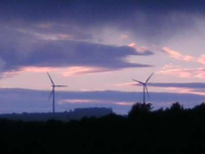
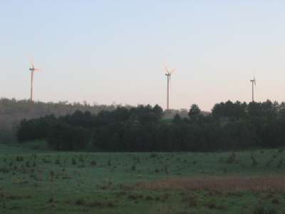 Wind turbine photos as seen from Rt. 219. About 10 minutes from Thomas, WV |
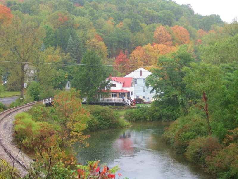
 19th century town of Gormania, WV about 7 miles away on West on Rt. 50. |
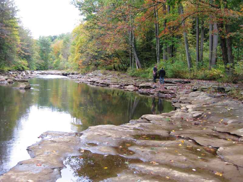
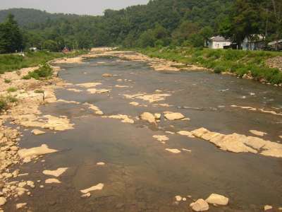 North Branch of the Potomac River in Kitzmiller, MD This is what Abram's Creek empties into |
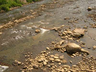 Another view of the shallow Potomac River Branch About 8 miles away passing through Elk Garden, WV |
 Subscribe to our newsletter